Good News!...
Read the Good News!...
Google Earth Now Shows Rain and Snow in Real Time: "

Google Earth is one of the great 'wow' applications in Google's stable, especially on touch devices like Android smartphones or the iPad, whether it's showing undersea formations or cities in 3-D. It's also surprisingly useful, and Google's always adding elements to it to give it more utility and/or fun.
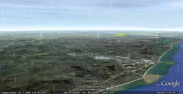
The newest is the clouds layer, which now shows rain and snow in real-time weather patterns, across the globe. After enabling the clouds layer, you can just zoom in to any location you want, provided Google has supplied the layer for the part you want to see. So far, that's limited to just parts of North America and Western Europe, but that includes some of the rainiest places I can think of, including the Pacific Northwest and the U.K. By enabling the radar layer, you can see where the precipitation data is available.
Maybe the coolest thing about the new feature is that it's in real time, updated as it actually happens. That means you can track weather patterns, storms (including scary ones like hurricanes), and watch them as they move across the map. It's potentially pretty useful, as the image above shows--that's Hurricane Alex, passing into Texas. Steer clear of there!
You can find the latest version of Google Earth here.
Dan Nosowitz, the author of this post, can be followed on Twitter, corresponded with via email, and stalked in San Francisco (no link for that one--you'll have to do the legwork yourself).
No comments:
Post a Comment